
MG tacticalC2
Portable . Ground Control . Instant Delopyment
A tactical command and control platform providing real-time 360-degree threat awareness. It is designed to enhance situational awareness for ground forces by integrating aerial data and supporting rapid decision-making in complex operational environments.
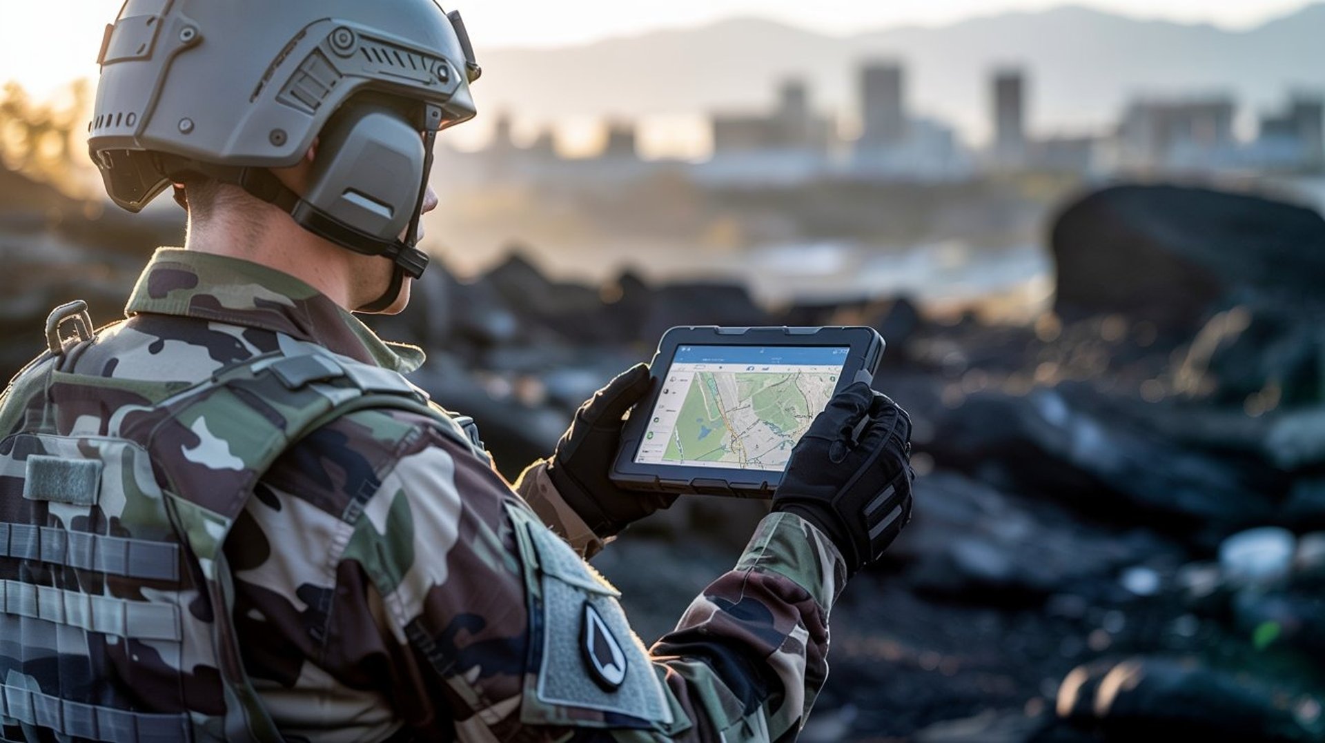


Interactive Tactical Map
Real Time Visualisation


Drone Management System
Team and Personal Awareness


Ground Unit Vital Sign Monitoring
Real Time IFF Drone Tracking
Interactive Tactical Map Interface
Red Markers : Unknown drones
Black Markers: Whitelisted or friendly drones
Playback of movement path of tag target or drone flight path for the last 5, 10, 30 or 60mins
Threat pattern analysis
Real Time Drone Detection In Range
Configurable Tracking Playback
Offline Map Capability
Navigate and operate in remote or sensitive communication zones with full map support
Tablet Based Location Awareness
Auto plotting of operator's current position using onboard GNSS
Geofence Visualisation
Display situational zones with operating radius options of 100m to 5000m to define various zoning perimeters or layers
Drone Management System
View all detected drones, sorting by threat status or activities
Select drones to zoom in on the map
Initiate tack playback
On the fly status update for whitelisting or unknown UAV
Real Time Drone Listing
Map Integration
Offline Map Capability
Navigate and operate in remote or sensitive communication zones with full map support
Whitelist Management
Maintain a secure database of friendly UAV
CUAS Interface
MG specialised add-on module with anti-jamming capabilities. Designed to securely connect external CUAS System to MG TacticalC2 over a custom radio wave that remains operational even when drone jamming is active
Secure encrypted communication under contested RF conditions
Bypass WIFI or public band limitation
Resilient against jamming and electronic warfare conditions
Compact and easy deployment
Ground Unit Vital Sign Monitoring
MG tacticalC2 combine aerial awareness with ground unit intelligence. With MG vitialsign integration, Commanders is able to monitor vital signs in real time monitor display mode.
Oxygen Saturation
Heartbeat
Intelligence Status
Body temperature
Ground unit status can be display on the same map interface for situation awareness, allowing commanders to quickly assess team condition, flag distress indicators and initiate emergency or medical response.
Features
Full Integration
MG droneIFF
Drone Identification
Display both unknown (Red), Whitelist (Black)
Mapping
Offline map (does not require internet)
Zoning Radius
100m, 500m, 1Km, 2Km, 5km, 10km
IFF Database
Whitelist, Teaming, Zoning, Annotate
Geo - Fencing Support
Different zoning and teaming identification
Ploting
Overlay with tactical map, icons and annotations
IFF Configuration
Tracking, Decaying, Flight Path, Flight Pattern